| 大人 | 子供 | ||
|---|---|---|---|
マッケンジーエクスプローラー 30 分 | NZ$315 Infant: NZ$195 | 予約はこちら |

こちらのフライトはテカポ湖とその周辺の山々の素晴らしい景色が広がり、山岳地帯に位置するファームに着陸し、テカポ湖周辺のパノラマな景色を楽しんで頂けます。冬の時期には、雪上着陸になります。
最も人気のあるヘリコプターのフライトのひとつです!夏も冬も一年中楽しめます。
主な特長は次のとおりです。
-
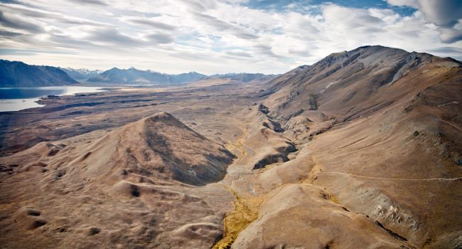
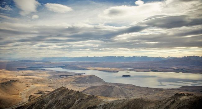
美しいターコイズブルーのテカポ湖とそこに注ぎ込む氷河湖からの河川。
-
テカポの村の様子。
-
マウントジョン天文台。
-
マウントヘイ、グレンモア&ゴドリーピークス高原牧場 - ホームステッドとメリノ羊が生息している高山地帯。
-
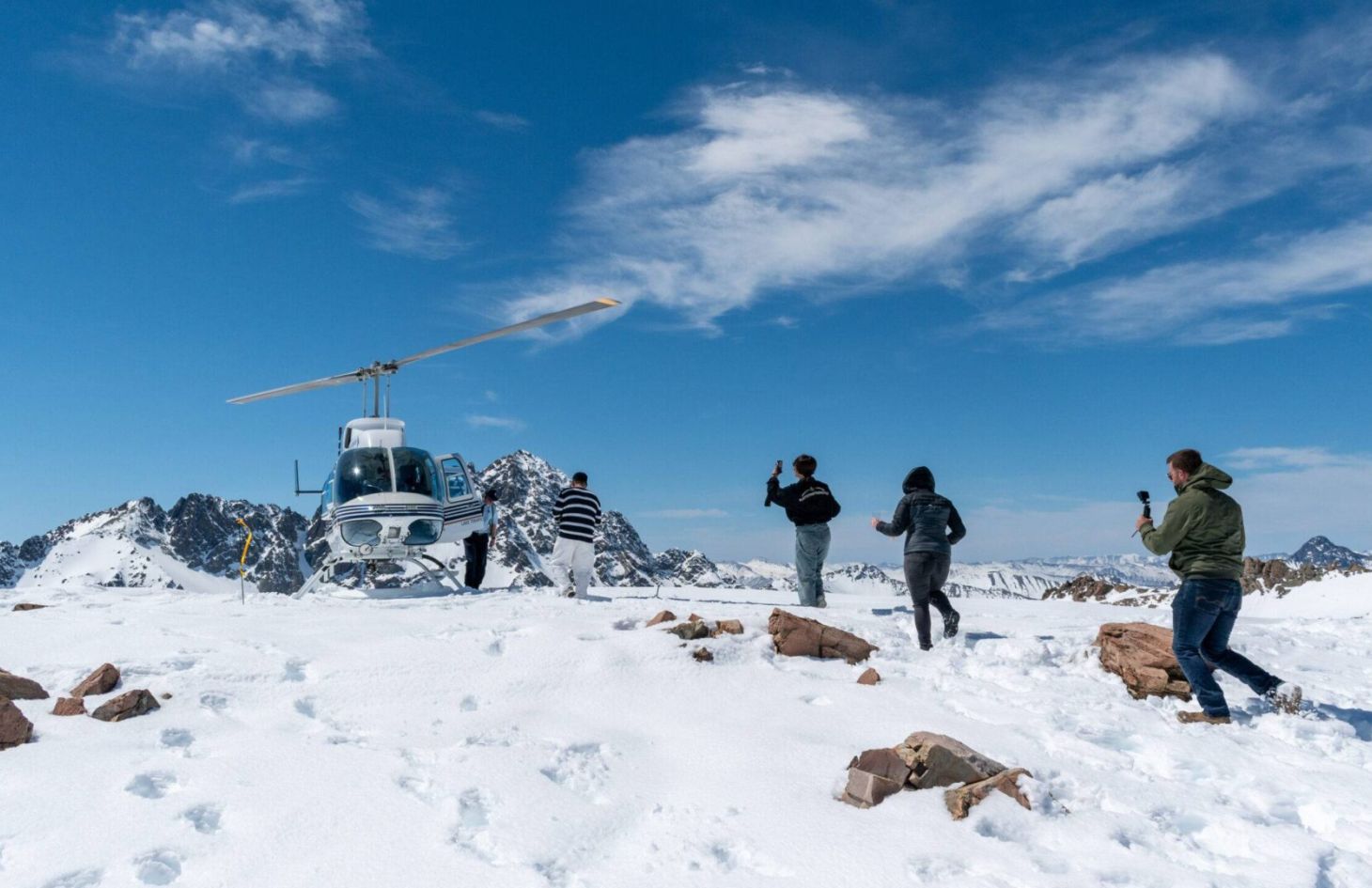
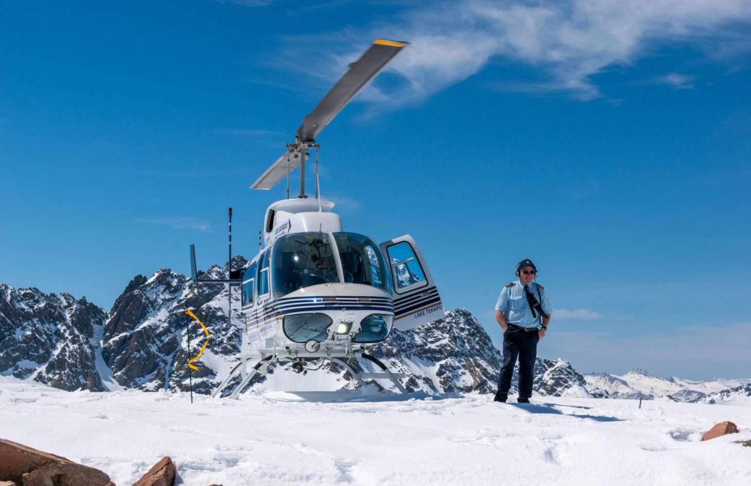
約1676mでの高山着陸(冬季のみ雪上)で、湖や山々のパノラマの景色を眺めることができます。
-
アレクサンドリーナ湖は湧き水の湖のため、テカポ湖とは対照的な色の違い。
-
最後の氷河期に氷が溶けた後に残された、巨大な「氷河が残した岩石」を含む古代の氷河堆積物。
正確なルートは、フライト当日の気象条件により異なる場合があります。
お一人様最大130kgまでの体重制限があります。
| 大人 | 子供 | ||
|---|---|---|---|
アルパイン グランデュア 45 分 | NZ$500 Infant: NZ$295 | 予約はこちら |
ヘリコプターによるこのフライトは、テカポ湖から山と渓谷を抜け、NZ最高峰アオラキ/マウントクック(3724m)へと近づく事が出来ます。テカポ湖周辺の高原地帯を見ながら、NZ最高峰と最長の氷河を見るために、マウントクック国立公園へ向かいます。
飛行の途中、アオラキ/マウントクックと周辺の山々のパノラマの景色を楽しむためにライビッグドーム(2347m)に雪上着陸致します。**2月~3月は雪の状況が限られる場合があります。
主な特長は次のとおりです。
-
美しいターコイズブルーのテカポ湖とそこに注ぎ込む氷河湖からの河川。
-
マウントジョン天文台。
-
グレンモア&ゴドリーピークス高原牧場。
-
急な険しい山々、そしてメリノの羊が生息するキャス、フォーク、ジョリーバレーの通り抜けます。これらの羊がどのように放牧されているのか、そしてその羊飼いのための山小屋などを見ながら、パイロットが詳しく案内致します。
-
タスマン氷河の下流に位置する、氷河湖と氷山を見下ろします。
-
驚くほど大きな氷山が浮かぶ氷河湖とプカキ湖へと流れ込むタスマン川
-
アオラキ/マウントクック&マウント・タスマンの素晴らしいパノラマの景色。
-
マーチソン氷河の下部を渡ってライビッグ山脈へ。
-
2347mのライビッグドームで雪上着陸を体験していただきます。(着陸場所は気象条件によって変わる可能性があります)2月~3月の夏の間は雪の状況が限られる場合があります。
-
アレクサンドリーナ湖は新鮮な湧き水の湖のため、テカポ湖とは対照的な色の違い。
-
最後の氷河期に氷が溶けた後に残された、巨大な「氷河が残した岩石」を含む古代の氷河堆積物。
正確なルートは、フライト当日の気象条件により異なる場合があります。
There is a maximum weight restriction of 130kg per person.
| 大人 | 子供 | ||
|---|---|---|---|
マウントクック フランツとフォックス マジック 60 分 | NZ$680 Infant: NZ$395 | 予約はこちら |

こちらの一番長い60分のヘリコプター遊覧は、テカポから始まり、入り組んだ山岳渓谷を越え、ニュージーランド最高峰のアオラキ/マウントクック(3724m)へと近づいていきます。経験の積んだパイロットの解説とともに、アオラキ/マウントクック国立公園の3000m級の山々と氷河の数々を見て頂けます。そしてサザンアルプスを越え、フランツとフォックス氷河をご覧いただき、そのあと東側へ戻って雪上着陸となります。
飛行途中、アオラキ/マウントクックと周辺の山々のパノラマの景色を楽しむためにライビッグドーム(2347m)に雪上着陸が含まれています。**雪の状況は2月-3月は限られることがあります。
主な特長は次のとおりです。
-
美しいターコイズブルーのテカポ湖とそこに流れ込む河川。
-
マウントジョン天文台。
-
グレンモア&ゴドリーピークス高原牧場。
-
急な険しい山々、そしてメリノの羊が生息するキャス、フォーク、ジョリーバレーの通り抜けます。これらの羊がどのように放牧されているのか、そしてその羊飼いのための山小屋などを見ながら、パイロットが詳しく案内致します。
-
タスマン氷河の下流に位置する、氷河湖と氷山を見下ろします。
-
驚くほど大きな氷山が浮かぶ氷河湖とプカキ湖へと流れ込むタスマン川
-
最高峰アオラキ/マウントクックとマウントタスマンを巡り、ウェストランド/タイ・プーティニ国立公園に入り、フランツジョセフ氷河とフォックス氷河の絶景を楽しんでいただけます。
-
タスマン氷河とマーチソンの氷河の上空を通り、ニュージーランド最長の氷河をご覧いただけます。
-
ライビッグドーム(2347m)にて素晴らしい雪上着陸を体験して頂けます。(着陸場所は気象条件によって変わる可能性があります)アオラキ/マウントクック国立公園のパノラマビューを堪能できます。雪の状況は2-3月は限られることがあります。
-
アレクサンドリーナ湖は新鮮な湧き水の湖のため、テカポ湖とは対照的な色の違い。
-
最後の氷河期に氷が溶けた後に残された、巨大な「氷河が残した岩石」を含む古代の氷河堆積物。
正確なルートは、フライト当日の気象条件により異なる場合があります。
お一人様最大130kgまでの体重制限があります。
| 大人 | 子供 | ||
|---|---|---|---|
テカポ ハイライト 15 分 | NZ$230 Infant: $140 | お問い合わせ |

ヘリコプターの遊覧を体験したいけど、ちょっと値段が高いな~と思っているあなたにピッタリなのがこちらのフライトです!
テカポ湖周辺の山々そして高山牧場など、素晴らしいマッケンジー地区の景色を楽しんで頂けます。着陸のオプションは含まれません。
主な特長は次のとおりです。
-
美しいターコイズブルーのテカポ湖とそこに流れ込む河川。
-
テカポの村の様子。
-
マウントジョン天文台。
-
グレンモア&ゴドリー ピークス ハイ カントリー シープ ステーション
-
アレクサンドリーナ湖は湧き水によって出来た湖のため、テカポ湖とは対照的な色の違い。
-
最後の氷河期に氷が溶けた後に残された、巨大な「氷河が残した岩石」を含む古代の氷河堆積物。
There is a maximum weight restriction of 130kg per person.


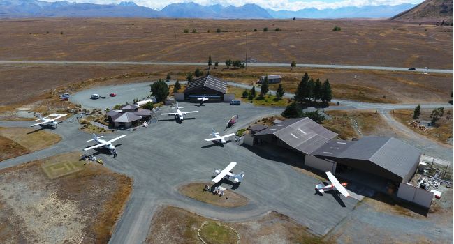
エアサファリ
テカポ湖空港
テカポ湖空港は、エアサファリによって1974年にここに建てられました。これは、会社の主な拠点であり、すべての東海岸のお客様の出発地です。
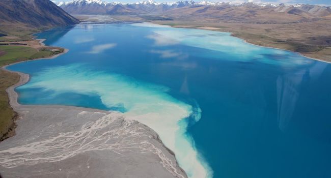
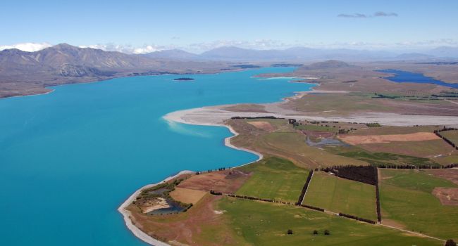
テカポ湖
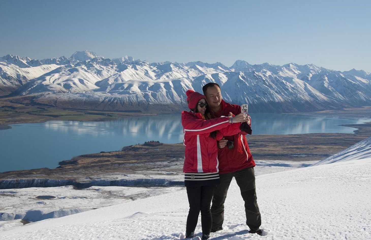
Lake Tekapo covers the first part of your Air Safaris Grand Traverse. Glaciers grinding against rock produce a fine powder called “rock flour”. When washed into the lake this is what produces the stunning turquoise colour. Lake Tekapo is 120m deep and has an average temperature of 7 degrees C. In the summer months it is popular for boating, water sports and trout and salmon fishing.
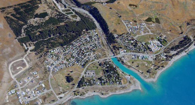
レイク テカポ ビレッジ
テカポ湖の南岸に位置するこの村には、約350人の永住者が住んでいます。村自体は、古い氷河の末端モレーヌに建てられ、空気から明らかになるユニークな氷河の特徴に囲まれています。
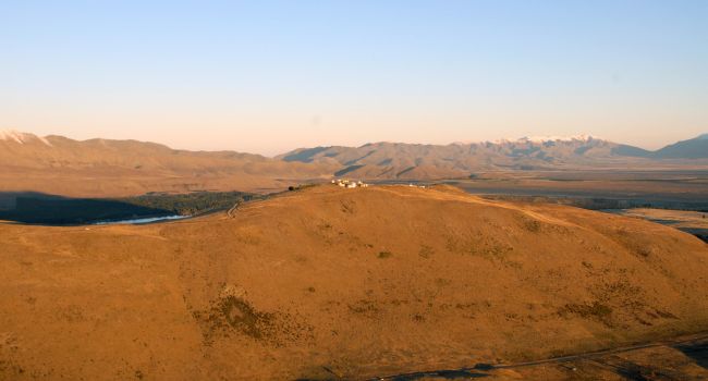
ジョン山
Dominating the skyline to the west of Lake Tekapo is Mt John – a classic example of a Roche Moutonnée (harder bed-rock sculptured by advancing glacial ice). Mt John is home to the Mt John Observatory housing New Zealand’s biggest telescope (1.8 meter MOA). Built in the 1960’s the observatory is now mainly used for research purposes by the Canterbury University.
干羊山駅
ヘイ山駅は、ラウンドヒルスキー場のすぐそばにあるテカポ湖の端にある10,500ha南島の羊農場です。
Mt Hay Station runs 5,000 merino because they’re the only stock sturdy enough to survive the hard country.
アードモア山
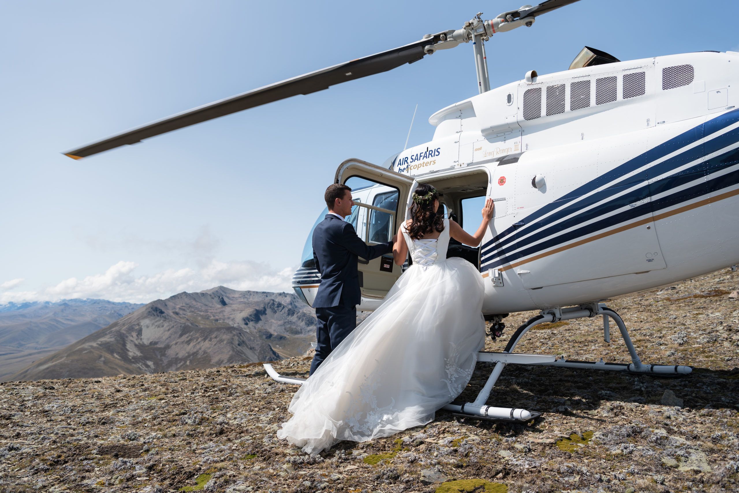
アードモア山は、テカポ湖の東側にある高山の上陸地点の一つで、テカポ湖の素晴らしい景色を望む遠く離れた山です。(これは私たちの結婚式や婚約写真のパッケージで非常に人気があります)。
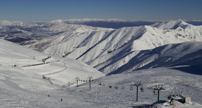
マウント ドブソン スキー場
Mt Dobson Ski Area is located in the Two Thumb mountain range east of Lake Tekapo village. It’s a perfect for all abilities with all day sun and a range of trails and lifts. The winter ski season runs from late June to early October.
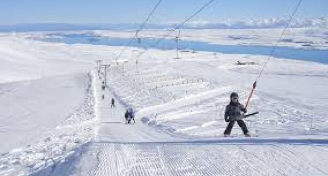
ラウンドヒル スキー場
高浦湖村から35分の場所に位置するラウンドヒルスキー場。このファミリーフレンドリーなスキー場からは、テカポ湖のパノラマの景色とあらゆるレベルの能力に合わせてトレイルを望めます。
ゴドリー ピークス シープ ステーション
この高い国の羊の駅は50 000エーカーの大きさです。彼らは約10,000人のメリノ羊を養殖しています。彼らは夏の間に山の上に高くグレーズし、深い冬の雪から保護するために、冬の間、羊飼いと彼らの犬によって下の国に徒歩で行きます。
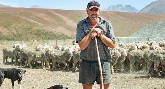
グレンモア シープ ステーション
グレンモア駅は、手賀浦湖の西岸からアオラキ/マウントクック国立公園の国境まで上昇し、19,000ヘクタールを占めています。受賞歴のあるメリノプロパティ(鹿と牛肉を含む)は、水の中に足を持ち、雪のピークに頭を持っています。
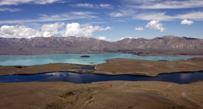
アレクサンドリーナ湖
Famous for Rainbow and Brown trout fishing, this springfed lake provides a striking contrast to the turquoise-blue glacial water of Lake Tekapo. The lake is one of New Zealand’s Scenic Reserves with over 40 species of bird within it’s biologically rich catchment.

ジョセフ山
ジョセフ山は、冬にここと夏の高山の上陸に雪の着陸を提供することができ、これはマッケンジー盆地の素晴らしい景色を持っています。
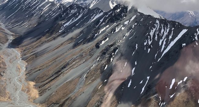
カスバレー
The Cass Valley lies to the west of Lake Tekapo between the Liebig and Hazsard Ranges. It’s a popular area for hiking and 4wd in summer and ski touring in the winter. The Cass River was named after Thomas Cass, the chief surveyor in Canterbury between 1851 and 1867.
ジョリーバレー
The Jollie River is a river of New Zealand’s Southern Alps. It flows an almost straight course from its source in the Liebig Range 15 kilometres (9 mi) east of Aoraki/Mount Cook, flowing into the Tasman River 5 kilometres (3 mi) from the latter’s outflow into Lake Pukaki.
アルパイン ハット
ウォーターフォール ハット

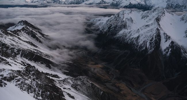
タスマン氷河湖
空からはっきりと見える氷山は、タスマン氷河の頂上にあるネヴェから今日の姿まで約500年かかりました。この湖の下の氷はまだ200メートル以上の厚さです。
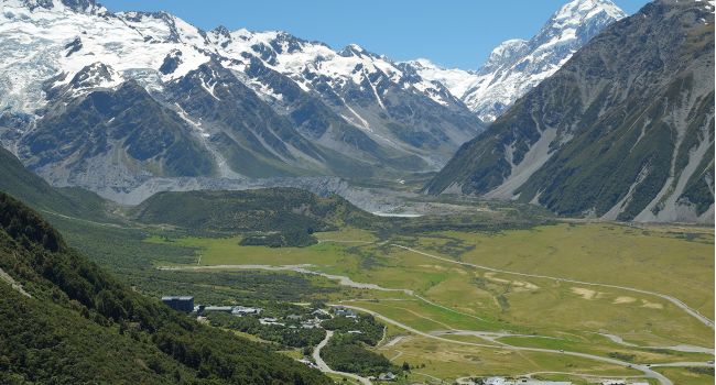
マウント クック ビレッジ
ニュージーランドで最も高い山の下、アオラキ/マウントクック高山村は、空を削るピーク、驚異的な氷河、永久的な雪、そしてすべての見事な星がちりばめられた空の下に座っています。
村自体は、国際的なスタイルのホテルからモーテル、バックパッカー、キャンプまで様々な宿泊施設を提供しています。
アオラキ/マウントクック国立公園は、土地の40%をカバーする氷河で700kmを超える村を囲んでいます。
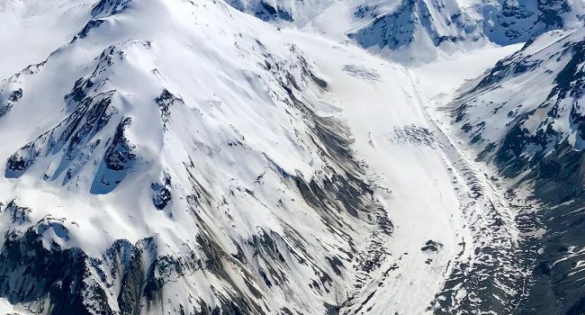
マーチソン氷河
16 kilometers long, the Murchison is New Zealand’s second longest glacier. Flowing in parallel valleys, the Tasman and Murchison Glaciers are separated by the Malte Brun range, dominated by Mt Malte Brun at 10,400′ (3,170m).
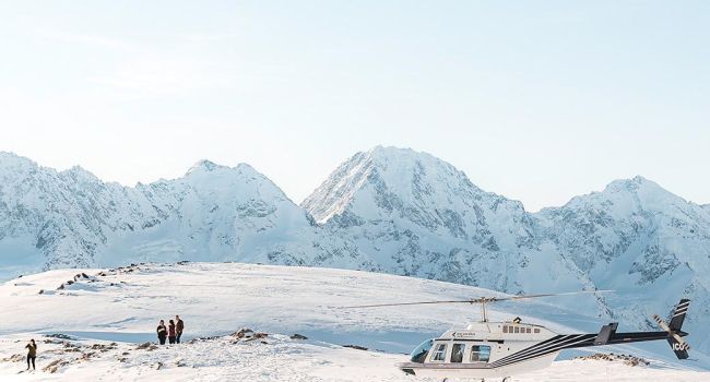
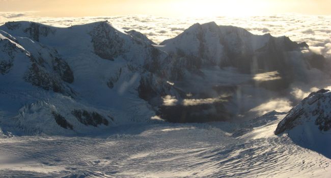
リービッグドーム
リービッグドームは、ニュージーランドの南アルプスの中に位置する私たちの雪の着陸地点の一つで、高さ約8000フィートに位置し、アオラキ・マウント・クックを背景に、この山は非常に人気のある着陸地点です。
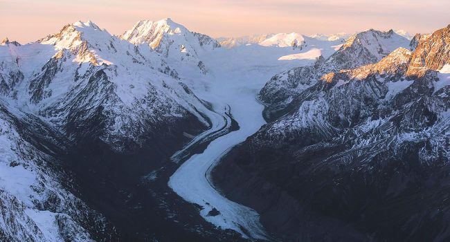
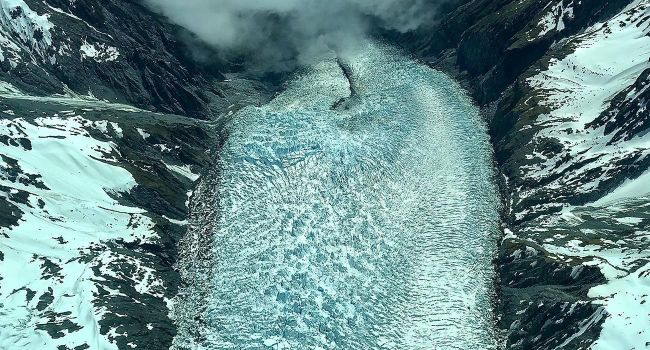
タスマン氷河
29 kilometres long with ice up to 800m deep, The Tasman is easily New Zealand’s longest glacier. Moraine (rock and gravel scraped or fallen from the valley walls) covers the ice for much of its length. At it’s terminus a glacial lake 150m deep and lined with ice, feeding into the huge braided Tasman River and then into Lake Pukaki.

マウント タスマン
Known as a classic ice-climb, Mt Tasman is New Zealand’s second highest mountain. It was first climbed in January 1895 by Mathias Zurbriggen. The Balfour icefall and glacier descends off its western flanks.
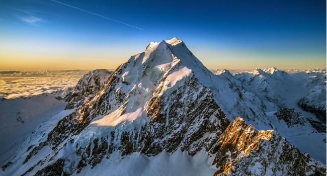
アオラキ/マウントクック
‘Aoraki’ – the cloud-piercer! New Zealand’s highest mountain stands supreme with its snow and ice-fields spilling into the glaciers below. It was first climbed on Christmas Day 1894 by locals Tom Fyfe, George Graham and 19 year old Jack Clarke. In 1991 a giant rock avalanche occurred on Mt Cook lowering the highest peak by 20m. An estimated 14 million cubic meters of rock and debris, travelled 7.3km from its source at an approximate speed of 400-600 km/hr.
フランツ・ジョセフ氷河
Nestled in the Westland National Park you will find the Franz Josef Glacier. At the head of the glacier is the beatiful Geike snowfield, famous for high altitude cross country skiing. Plummeting steeply westward, this magnificent ‘river of ice’ descends almost to the Tasman sea at a recorded rate of up to 4 meters per day.
フォックス氷河
The Maori name for the Fox Glacier is “Te Moeka o Tuawe” this was derived from the ancestor Tu Awe who fell to his death while exploring the area. The bed of the glacier was his finial resting place and it is said that when his lover, Hine Hukatere wept, the bed of the Fox and Franz glaciers filled with her everlasting tears of ice.
-
![uk-img="target:]()
エアサファリ
テカポ湖空港テカポ湖空港は、エアサファリによって1974年にここに建てられました。これは、会社の主な拠点であり、すべての東海岸のお客様の出発地です。
-
![uk-img="target:]()
テカポ湖
Lake Tekapo covers the first part of your Air Safaris Grand Traverse. Glaciers grinding against rock produce a fine powder called “rock flour”. When washed into the lake this is what produces the stunning turquoise colour. Lake Tekapo is 120m deep and has an average temperature of 7 degrees C. In the summer months it is popular for boating, water sports and trout and salmon fishing.
-
![uk-img="target:]()
レイク テカポ ビレッジ
テカポ湖の南岸に位置するこの村には、約350人の永住者が住んでいます。村自体は、古い氷河の末端モレーヌに建てられ、空気から明らかになるユニークな氷河の特徴に囲まれています。
-
![uk-img="target:]()
ジョン山
Dominating the skyline to the west of Lake Tekapo is Mt John – a classic example of a Roche Moutonnée (harder bed-rock sculptured by advancing glacial ice). Mt John is home to the Mt John Observatory housing New Zealand’s biggest telescope (1.8 meter MOA). Built in the 1960’s the observatory is now mainly used for research purposes by the Canterbury University.
-
![uk-img="target:]()
干羊山駅
ヘイ山駅は、ラウンドヒルスキー場のすぐそばにあるテカポ湖の端にある10,500ha南島の羊農場です。
Mt Hay Station runs 5,000 merino because they’re the only stock sturdy enough to survive the hard country.
-
![uk-img="target:]()
アードモア山
アードモア山は、テカポ湖の東側にある高山の上陸地点の一つで、テカポ湖の素晴らしい景色を望む遠く離れた山です。(これは私たちの結婚式や婚約写真のパッケージで非常に人気があります)。
-
![uk-img="target:]()
マウント ドブソン スキー場
Mt Dobson Ski Area is located in the Two Thumb mountain range east of Lake Tekapo village. It’s a perfect for all abilities with all day sun and a range of trails and lifts. The winter ski season runs from late June to early October.
-
![uk-img="target:]()
ラウンドヒル スキー場
高浦湖村から35分の場所に位置するラウンドヒルスキー場。このファミリーフレンドリーなスキー場からは、テカポ湖のパノラマの景色とあらゆるレベルの能力に合わせてトレイルを望めます。
-
![uk-img="target:]()
ゴドリー ピークス シープ ステーション
この高い国の羊の駅は50 000エーカーの大きさです。彼らは約10,000人のメリノ羊を養殖しています。彼らは夏の間に山の上に高くグレーズし、深い冬の雪から保護するために、冬の間、羊飼いと彼らの犬によって下の国に徒歩で行きます。
-
![uk-img="target:]()
グレンモア シープ ステーション
グレンモア駅は、手賀浦湖の西岸からアオラキ/マウントクック国立公園の国境まで上昇し、19,000ヘクタールを占めています。受賞歴のあるメリノプロパティ(鹿と牛肉を含む)は、水の中に足を持ち、雪のピークに頭を持っています。
-
![uk-img="target:]()
アレクサンドリーナ湖
Famous for Rainbow and Brown trout fishing, this springfed lake provides a striking contrast to the turquoise-blue glacial water of Lake Tekapo. The lake is one of New Zealand’s Scenic Reserves with over 40 species of bird within it’s biologically rich catchment.
-
![uk-img="target:]()
ジョセフ山
ジョセフ山は、冬にここと夏の高山の上陸に雪の着陸を提供することができ、これはマッケンジー盆地の素晴らしい景色を持っています。
-
![uk-img="target:]()
カスバレー
The Cass Valley lies to the west of Lake Tekapo between the Liebig and Hazsard Ranges. It’s a popular area for hiking and 4wd in summer and ski touring in the winter. The Cass River was named after Thomas Cass, the chief surveyor in Canterbury between 1851 and 1867.
-
![uk-img="target:]()
ジョリーバレー
The Jollie River is a river of New Zealand’s Southern Alps. It flows an almost straight course from its source in the Liebig Range 15 kilometres (9 mi) east of Aoraki/Mount Cook, flowing into the Tasman River 5 kilometres (3 mi) from the latter’s outflow into Lake Pukaki.
-
アルパイン ハット
ウォーターフォール ハット -
![uk-img="target:]()
タスマン氷河湖
空からはっきりと見える氷山は、タスマン氷河の頂上にあるネヴェから今日の姿まで約500年かかりました。この湖の下の氷はまだ200メートル以上の厚さです。
-
![uk-img="target:]()
マウント クック ビレッジ
ニュージーランドで最も高い山の下、アオラキ/マウントクック高山村は、空を削るピーク、驚異的な氷河、永久的な雪、そしてすべての見事な星がちりばめられた空の下に座っています。
村自体は、国際的なスタイルのホテルからモーテル、バックパッカー、キャンプまで様々な宿泊施設を提供しています。
アオラキ/マウントクック国立公園は、土地の40%をカバーする氷河で700kmを超える村を囲んでいます。
-
![uk-img="target:]()
マーチソン氷河
16 kilometers long, the Murchison is New Zealand’s second longest glacier. Flowing in parallel valleys, the Tasman and Murchison Glaciers are separated by the Malte Brun range, dominated by Mt Malte Brun at 10,400′ (3,170m).
-
![uk-img="target:]()
リービッグドーム
リービッグドームは、ニュージーランドの南アルプスの中に位置する私たちの雪の着陸地点の一つで、高さ約8000フィートに位置し、アオラキ・マウント・クックを背景に、この山は非常に人気のある着陸地点です。
-
![uk-img="target:]()
タスマン氷河
29 kilometres long with ice up to 800m deep, The Tasman is easily New Zealand’s longest glacier. Moraine (rock and gravel scraped or fallen from the valley walls) covers the ice for much of its length. At it’s terminus a glacial lake 150m deep and lined with ice, feeding into the huge braided Tasman River and then into Lake Pukaki.
-
![uk-img="target:]()
マウント タスマン
Known as a classic ice-climb, Mt Tasman is New Zealand’s second highest mountain. It was first climbed in January 1895 by Mathias Zurbriggen. The Balfour icefall and glacier descends off its western flanks.
-
![uk-img="target:]()
アオラキ/マウントクック
‘Aoraki’ – the cloud-piercer! New Zealand’s highest mountain stands supreme with its snow and ice-fields spilling into the glaciers below. It was first climbed on Christmas Day 1894 by locals Tom Fyfe, George Graham and 19 year old Jack Clarke. In 1991 a giant rock avalanche occurred on Mt Cook lowering the highest peak by 20m. An estimated 14 million cubic meters of rock and debris, travelled 7.3km from its source at an approximate speed of 400-600 km/hr.
-
![uk-img="target:]()
フランツ・ジョセフ氷河
Nestled in the Westland National Park you will find the Franz Josef Glacier. At the head of the glacier is the beatiful Geike snowfield, famous for high altitude cross country skiing. Plummeting steeply westward, this magnificent ‘river of ice’ descends almost to the Tasman sea at a recorded rate of up to 4 meters per day.
-
![uk-img="target:]()
フォックス氷河
The Maori name for the Fox Glacier is “Te Moeka o Tuawe” this was derived from the ancestor Tu Awe who fell to his death while exploring the area. The bed of the glacier was his finial resting place and it is said that when his lover, Hine Hukatere wept, the bed of the Fox and Franz glaciers filled with her everlasting tears of ice.
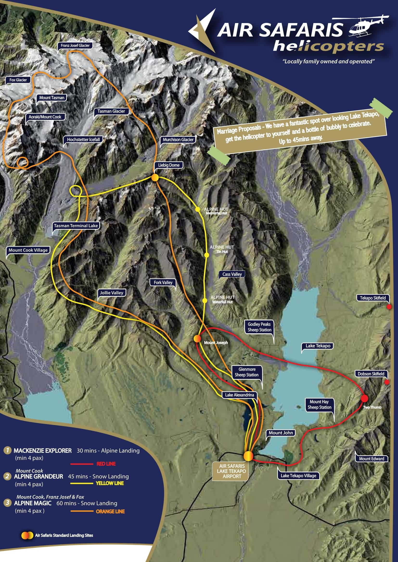
ヘリコプタールートマップ
Marriage Proposals – We have a fantastic spot over looking Lake Tekapo, get the helicopter to yourself and a bottle of bubbly to celebrate.
45分-
30 mins – Alpine Landing
(min 4 pax) -
45 mins – Snow Landing
(min 4 pax) -
60 mins – Snow Landing
(min 4 pax)